Ideal Cruise through the North Channel (historic)

September 29, 2010
From Drummond Island, Michigan (NC-1)
To Baie Fine, Ontario (NC-83)...
100 nautical miles
Ideal Cruise quick reference...
| Type of report | overview of area |
| US Charts | NOS 14860, 14880, 14881, 14882 |
| Cdn Charts | CHS 2204, 2205, 2206, 2207, 2251,2257, 2258, 2259, 2268, 2286, 2299 |
| US Customs | Drummond Island |
| Cdn Customs | 1-888-CAN-PASS |
| Telephone area code | 705, 906 |
| GLCC Port Captains | yes |
Introduction
This report is directed to the novice, for who would dare to tell those who have been to the North Channel which ports are "ideal." The North Channel is one of the finest cruising grounds in all the world. Fresh water, beautiful scenery, secluded spots, and historic interest make it a most popular destination.
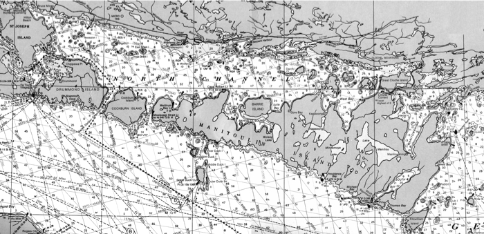
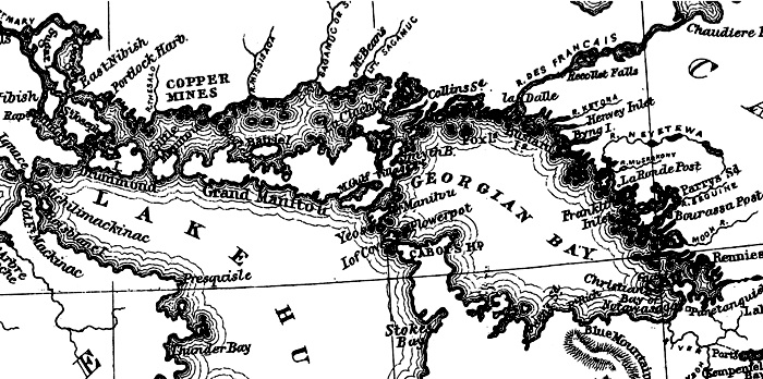
The North Channel is that portion of Lake Huron which lies north of the three major islands: Drummond, Cockburn (pronounced Co-burn), and Manitoulin.
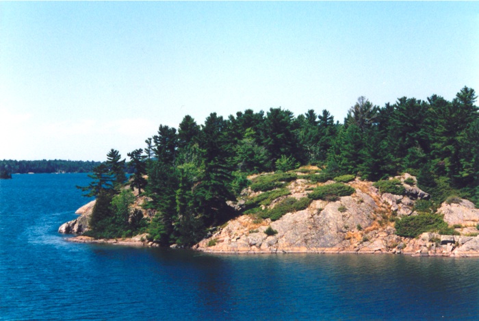
Manitoulin Island is the largest fresh water island in the world, having an area of 1,223 square miles. It is roughly 80 miles long but so indented with deep bays that the width varies from 3 to 30 miles. There are said to be 108 lakes on Manitoulin, some large enough to dwarf islands as much as a mile long which lie within these lakes.
The scenery—both on Manitoulin and along the adjoining coast—is rugged and precipitous. The entire island is limestone, an outcropping of the same formation as the bluffs in Green Bay and the Niagara Ledge at Niagara Falls. Much interest may be added to your cruising if you will peruse the pages of a geology text.
It being the announced purpose of this article to present an "Ideal Cruise" through the North-Channel country, we will now ask that you open out a chart (or charts) of this entire area. US Chart 14860 will do nicely for general planning, though many more detailed charts will be required for the actual navigation.
Spread out before you is the North Channel, some 100 nautical miles long from Detour passage on the west to Killarney on the east. At its widest, the Channel is about 16 miles, and at its narrowest scarcely 200 yards. There are innumerable islands, reefs, headlands, bays, and channels to be navigated. If this sounds formidable, be not alarmed, as you will find a dividend of much sheltered cruising among these islands.
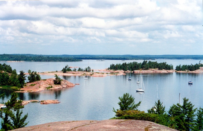
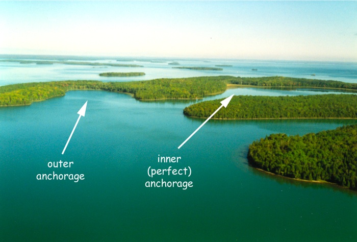
The beautiful Benjamins. Photo by Jo Schneider...
Although our ideal cruise is outlined as a loop starting and finishing at Mackinac Island, it will readily be seen that one may start at any convenient port, or even take the circuit in reverse order. The most desirable alternative is probably the Les Chenaux Islands using Hessel, Cedarville, or an anchorage in Government Bay, all lying a scant 11 to 16 miles northeast of Mackinac. Alternate harbors might be Mackinaw City, St. Ignace, Cheboygan, DeTour Village, or perhaps Rogers City.
The North Channel circuit is planned for about two weeks, with a fine protected harbor available every night, spaced for 20- to 50-mile runs each day. Obviously a small sailboat would struggle to make those distances and would want to shorten the trip or lengthen the time available. A fast cruiser can do the circuit in half that time but will sacrifice much of the "feel" of the country.
Manitoulin Island is the legendary home of "Gitche Manitou," the Great Spirit of the Indians. It has a mysterious "something" about it, which the natives call the "Spell of Manitoulin." It was once the home of the Ottawas and the rendezvous for many other tribes which gathered each year to receive their payments from the French or English governments. The native language of the Indians on this island is Ojibway. It is magic country, with over 350 years of history and legend dating from the time that Champlain and Etienne Brulé first visited these waters in July of 1615.
Foreign Travel
Although Drummond Island is US territory, beyond that we will be in Canadian waters, so our first thought is of Customs and immigration requirements.
Customs requirements are fairly straightforward, so that as of this writing one need only contact Canadian officials once (at the port of entry), and then US officials once (at a port of entry) upon returning to US waters. Each should be done as soon as possible after entering that jurisdiction and before anchoring or stepping ashore. Considering the times, it would be prudent to watch for announcements of changes to the rules, especially from the US side.
The most convenient Ports of Entry will probably be Meldrum Bay (NC-10) for Canada and Drummond Island (NC-1) for US. US Customs require that you purchase a re-entry decal for $25, if your boat is over 26-feet. If you have not already obtained a decal, stop at Drummond Island Yacht Haven (NC-1) or Whitney Bay (H-52) where a decal for re-entry to the United States can be purchased from US Customs and then proceed to Meldrum Bay (NC- 10) to enter Canada. Alternate Canadian customs ports in the North Channel are Richard's Landing (NC-72), Thessalon (NC-63), Blind River (NC-59), and Gore Bay (NC-14). Phone-in reporting is the standard procedure—dial 1-888-CAN-PASS. A small number of entering boats will be instructed to wait for the arrival of an inspecting officer. Note that US Immigration is separate from US Customs, and at this writing the rules for the US/Canadian Border are in flux.
Planning The Cruise
Take the charts and GLCC Port Pilot and familiarize yourself with the harbors to be used as overnight stops. At most of them you will anchor out—most people cruise the North Channel to get away from civilization.
Our first night is planned for Harbor Island (NC-2) near Drummond; then, in order, Meldrum Bay (NC-10), Gore Bay (NC-14) through Little Current to Browning Cove (NC-77), Mill Lake in Collins Inlet (GB-50), Covered Portage (GB-53), The Pool in Bay Finn (NC-83), back west through Little Current to Sturgeon Cove (NC-28.5), through the Benjamin Islands to Fox West Harbour (NC- 27), Beardrop Harbour (NC-51), Pilot Cove (NC-7), thence along the south shore of Drummond Island to Whitney Bay (H-52), and then back to Mackinac Island. The above sequence is planned to minimize bucking the head seas of the prevailing westerlies, and at the same time to put the more involved navigational problems into the latter part of the cruise.
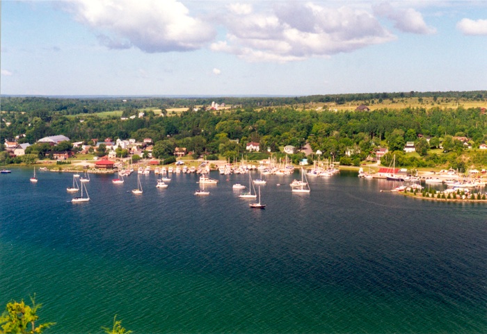
Gore Bay (NC-14), a major port of call. This superb harbour has been the site of six GLCC annual Rendezvous since 1965. The photo is taken from the spectacular bluff on the east shore of Gore Bay, looking southwest at the village and city marina. Photo by Fred Locke...
There are 5 GLCC Charts filed in the Port Pilot and Log Book, of which at least Chart No. 2, filed at (NC-22), will be required. The others are optional for side trips. At Turner's store in Little Current, you may wish to buy a copy of what is known as the "Defoe" Chart as it shows Bay Finn on a much larger scale than otherwise available, although Chart 2205 is quite acceptable.
Looking northwest over Harbor Island. Fred May photo...
First Day
Charts: NOS 14880, 14881, 14882
With charts, food, fuel, and crew aboard, let us depart Mackinac Island for the North Channel. Unless taking a side trip through Les Cheneux Islands (H-81), lay a course to pass just south of Martin Reef Light, thence to DeTour Light. Whitney Bay (H-52), which we may visit on our return, lies just to the east.
Going north through DeTour passage, you may want to stop at the DeTour Village Marina (H-82) for re-fueling and re-provisioning. Leaving the docks, you head for the red buoy off Sims Point and enter the North Channel.
The immediate problem is to identify the many islands ahead, particularly Bow Island. If you start looking for it early enough, before passing Black Rock Point, you may note that a line of sight tangent to Black Rock Point and Sims Point is also tangent to the north tip of Bow Island. Finding and using such natural pointers (ranges) is half the fun of cruising these waters.
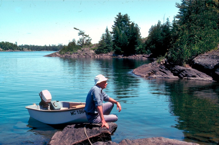
Give Sims Point a safe clearance, then swing east between Bow and Surveyors Islands, then see NC-1 for the approach to Drummond Island Village. Fuel and some supplies are available here. Pull off to Harbor Island (NC-2) and anchor for the night in its perfect protection.
Day's run, 42 nautical miles
Second Day
Charts: US 14882, CHS 2295
Head north along the west sides of Harbor Island and Standerson Island holding toward the east tip of Wilson Island.
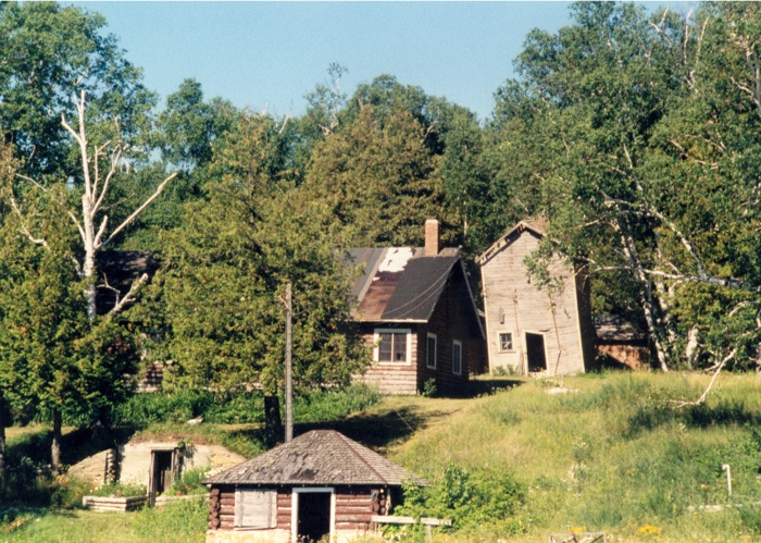
The ruins at Clapperton's Harbour Island (NC-21.5), once a thriving resort. The anchorage is still excellent, but the old buildings are becoming dangerous to explore. Photo by Rodney Deitz...
As soon as you are clear north of Standerson Island (N tip of Standerson in line with NE tip of Harbor Island) you may swing northeasterly for the gap off Chippewa Point, passing about midway between Propeller Island and Cherry Island. But enough of such detailed directions. A little study of the charts and the careful navigator will have few problems.Continue around Drummond Island, past Cockburn Island (NC-9) and on to Meldrum Bay (NC-10) for Canadian Customs, fuel, stores, fishing license, and a dock where you may stay tied securely for the night (or a good anchorage just south of the docks, provided the wind is not from the northeast).
Day's run, 37 nautical miles
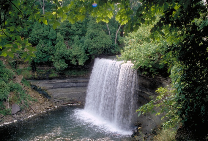
The Bridal Veil Falls at Kagawong, a worthwhile side-trip. Photo by Ron Dwelle...
Third Day
Charts: CHS 2251, 2257
On the way out of Meldrum Bay, leave Batture Island and its small red buoy well to starboard; thence easterly past Bayfield Sound, Julia Bay, and into Gore Bay. Supplies of fuel and food may be replenished at one of the major ports of the North Channel.
It is suggested that we go on a few more miles, with an overnight anchorage in the generous harbor at Clapperton's Harbour Island (NC-21.5). Some years ago this was operated as a resort. but it has not been open in recent years.
Day's run, 35 nautical miles
Alternates: Kagawong (NC-15) or Logan Bay (NC-21.4) If the morrow dawns clears, we might take a brief side trip to Kagawong and hike up to the Bridal Veil Falls, as it is well worth the hike. It is perhaps five miles to the government dock at Kagawong, with good shelter except in north winds.
Fourth Day
Charts: CHS 2207, 2294, 2205
Lay a course from Harbour Island for Little Current (NC- 17), passing south of Meredith Rock lighted beacon, then south of the red spar a mile to the east, and also south of the flashing red buoy at James Foote Patch. From here it is an easy 6 miles into Little Current. This is the metropolis of the North Channel, so take time to replenish supplies, buy any charts you may have overlooked, etc., as we have only another 7 miles to go today.
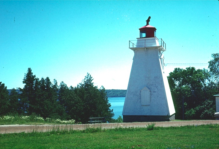
History abounds on Manitoulin Island. A visit to this historic lighthouse at Manitowaning will be rewarding! Photo by Ron Dwelle...
Now on Chart 2205, after passing through the Little Current swing bridge, follow the buoyed channel eastward again until off Strawberry Island light, thence lay a course for Browning Cove (NC-77) in Heywood Island. Identify the entrance with care, then proceed due south through the middle of the passage between Stanley Point and Browning Island. There is a fine sand beach straight ahead, and a perfectly protected anchorage in the west arm of the bay.
Day's run, 22 nautical miles
Alternate: the east arm of the bay, or Beaver Island Harbour (NC-76) on the south end of Strawberry Island.
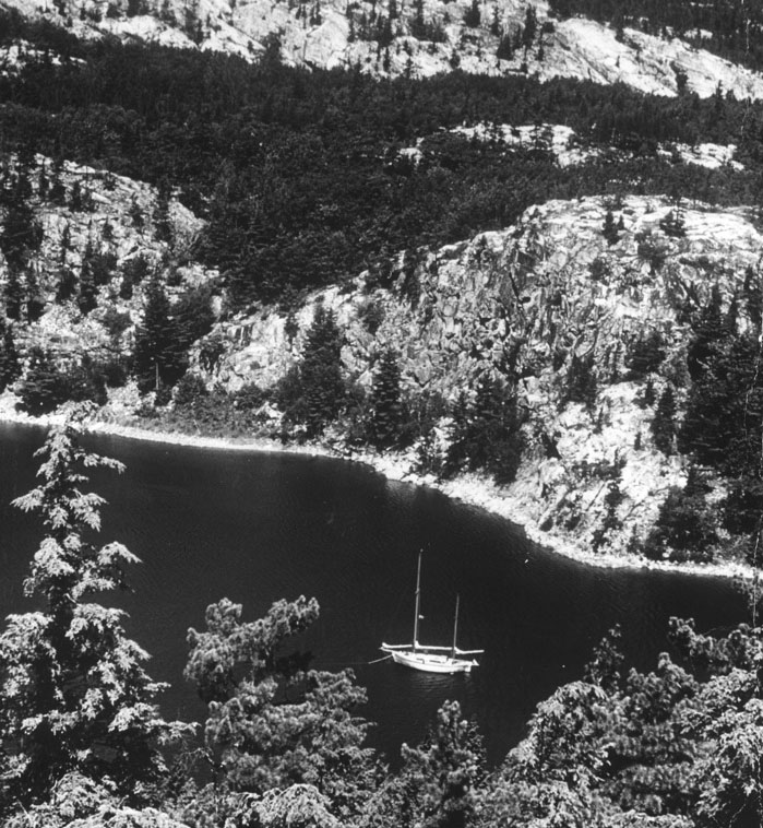
Lovely anchorage between Killarney and Collins Inlet. Photo by Jim Wooll...
Fifth Day
Charts: CHS 2205, 2204
Today we are off to Collins Inlet which will be our turning point for this cruise. We have several choices of route, so let's go one way and come back another. In leaving the harbor at Browning Cove, be sure to pass north of the green spar on Shoal Island Spit, thence easterly off Heywood Rock to the green spar on Split Rock. Standing as it does in 10 fathoms, this is a very spectacular rock. It is just below the surface at LWD, and if weather permits, you may approach it with care, to see or photograph it.
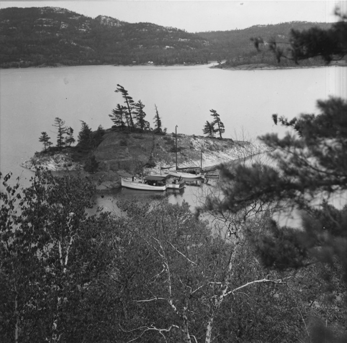
Scene in Baie Fine, 75 years ago, and as it will look 70 years from now—only the boats will change...
From here, pass south of Partridge Island to pick the "Lights in Line" (072.5º T) range of the two lighthouses on Badgeley Island. Stay on this range until past Centre Island Bank lighted buoy, then modify course to pass safely south of Kokanongwi Island and Kokanongwi Shingle, a pile of stones 5 to 8 feet high. A northeasterly heading should then carry you along George Island to the east entrance to Killarney (GB-52.0). Unless you need supplies we will bypass this port until the morrow.
Switch now to Chart 2204 (Sheet 4) which shows the remainder of the route in great detail. In the balance of the day, there should remain ample time to explore Collins Inlet (GB-50.5) at least as far as Mill Lake (GB-50). You may explore Mill Lake as far as the chart shows good water, but select an overnight anchorage well before dusk. There is ample room and good holding just SSW of Green Island. Take the skiff down to the hidden slit at the south end of Mill Lake.
Day's run, about 26 miles
Beautiful spot in the Barren Island area—little visited and pristine. Photo by Jo Schneider...
Sixth Day
Charts: CHS 2204, 2205
There remain four more miles of Collins Inlet leading to Beaverstone Bay (GB-49.1). It would take considerable time to explore all of Beaverstone Bay, but—providing your draft is shallow enough—you may wish to run the buoyed course shown on 2204. This leads to the "Eastern Entrance" where, another year, you may extend your cruising to French River (GB-45.1), and other fabulous ports of the Georgian Bay.
However, we have planned to turn back here and retrace our route to Killarney (GB-52) where we again take time out to restock supplies. As this is a much smaller town, do not expect it to compare with Little Current, but don't miss the fried fish sold at the bus on the government dock.
Our destination for the night is Covered Portage (GB-53) on Chart 2205. Ample directions will be found in GB-53. Go slowly and don't cut corners, especially at the rock ledge between the letter "e" of the word cove (Covered Portage Cove) on 2205, and the nearby depth of 11 feet. There is a scant one foot here at LWD. Once inside Covered Portage, you have as perfect protection as can be found, in the midst of scenery that will bring you back many times.
Day's run, about 24 nautical miles.
Small island north of Little Current—worth exploring! Photo by Jo Schneider...
Seventh Day
Charts: CHS 2205, 2286
Upon leaving Covered Portage, retrace the route almost to Killarney, thence pass just north of the green buoy sighted on Ann Long Bank. Run about one mile toward the gap between Badgeley Island and Kokanongwi Island, until you see the daymarks of the "Light in Line" (295º T) range leading to the Lansdowne Channel. These entering daymarks to the channel are a dull orange color, well up on the hillside, and rather hard to see.
(Alternately starting from Covered Portage Cove, Chart 2205 will let you go west along the north shore without returning to Killarney, but be sure you stay in the northerly half of this channel.)
Open your GLCC Port Pilot and Log Book to NC-79 for an expanded chart of the Lansdowne channel. Take time to swing in to Snug Harbour (NC-79.2) midway through this channel. Those adventurously inclined should also note the report on Hole-In-The-Wall (NC-79.5).
Porcupine Island in the Benjamins: a "tight" little cove. 1962 photo by Howard Blossom...
Upon leaving the Lansdowne Channel, clear Boat Rock, then swing north for the tip of McGregor Point. There are two acceptable routes to Bay Finn, but the deepest and easiest for navigation is to run due north on a course of 000º T, almost to the beacon painted on the tip of McGregor Point, passing between a red and a green buoy enroute. Follow the south shore of McGregor Point easterly, holding 50 to 100 yards off shore, with due attention to the several charted spars. Pass through the narrows at Fraser Point—on your right is the former Okeechobee Lodge, now a private compound.
Oak Bay has many snug coves—you can put a stern-anchor out and tie up to the rock face in the center of the photo. Then step off the bow onto shore. Photo by Ron Dwelle...
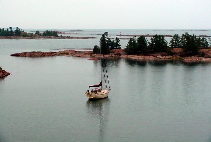
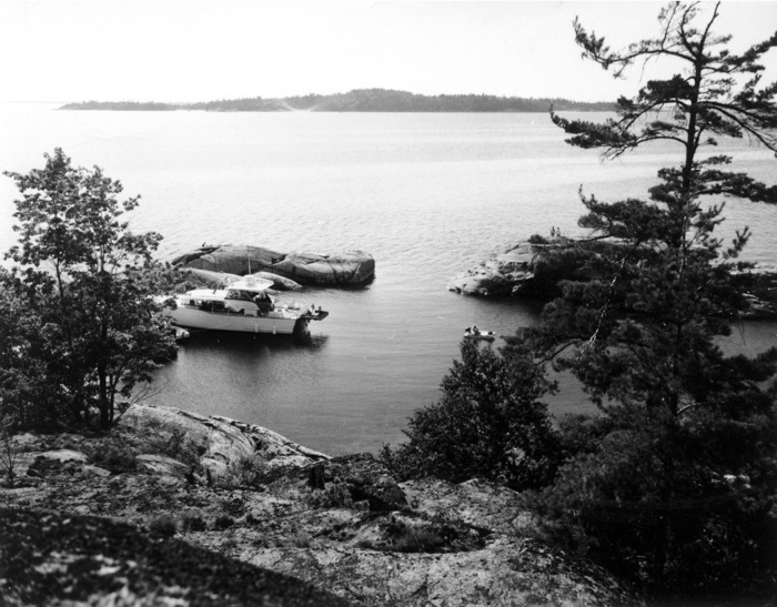
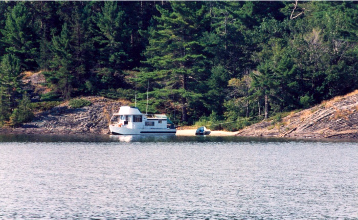
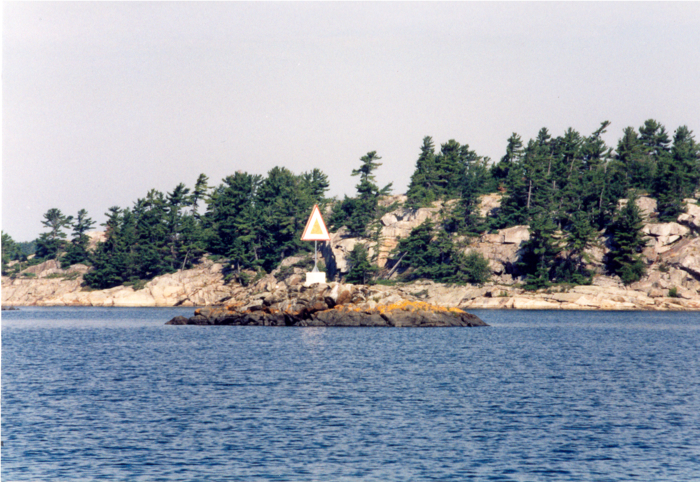
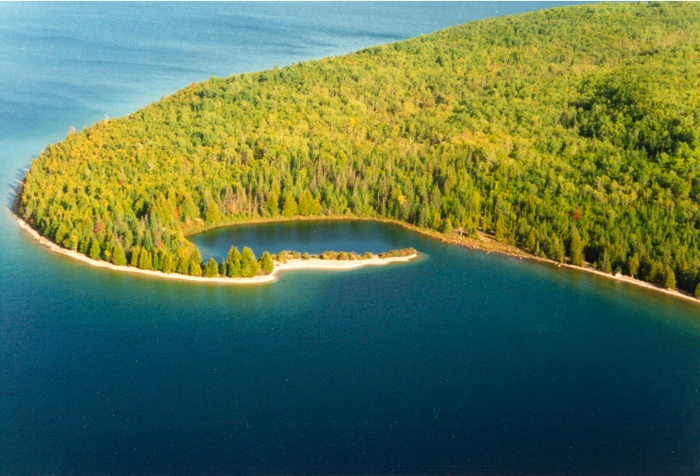
This is the beginning of Bay Finn (NC-83). Directions, map, and air photos in the harbor report should permit safe navigation to "The Pool" at the far end. Caution: Note that island number 612 is usually submerged, and becomes an unmarked hazard. Let us hope for bright sunshine as you travel these waters so that you can shoot plenty of color film on this near equivalent to the fjords of Norway. Anchor for the night in The Pool, being sure the anchor is "set" through the weeds on the bottom.
Day's run, about 26 nautical miles.
Eighth Day
Charts: CHS 2207, 2294
Retrace your route to a point near Heywood Island; thence to Little Current for supplies. If the kids are aboard, they would probably love to see a real wreck, so here is a good chance to oblige. This is a sizeable vessel, several feet below LWD and easily seen on a calm day. It lies just north of West Mary Island (NC-91), about two miles north of Heywood Island. From McGregor Point off Bay Finn, run south until the north point of West Mary Island is in line with the north point of East Mary Island. Follow this range, passing north of both islands. The wreck is not marked, so approach with caution.
From here you may depart on a SW course toward Strawberry Island, thence toward Little Current (NC-17). Stock up well, as we have considerable to see before the next shopping port.
From the west entrance to Little Current, go north in the Wabuno Channel, then east for two miles to Sturgeon Cove (NC-28.5). At one time there was a government range at this harbor, but it has been officially removed and is no longer available. It requires three sets of ranges to properly define the deep water of this entrance.
Little Detroit—one of the tight spots in the North Channel. Photo by Ron Dwelle...
From well offshore, the first mark, a white painted triangle should be visible on the western entrance point. The back range is another white triangle high in a pine tree from the front range. The next range is diamonds in line, on the eastern shore. Lastly, there are circles in line which tell you when to turn in to the harbor. Study report NC- 28.5 so you will be familiar with how it is done. And be sure to make your turns before you overrun any range line.
If you anchor in the west end of the harbor, you may want a stern anchor to hold the bow pointed toward the entrance or you may roll gently all night. This is not a problem in the east end of the harbor.
Day's run, 31 miles.
Alternate: Bell Cove (next door) or Bay of Islands (just east).
Besides the major harbor, "gunkholes"—like this one in the Whalesback—abound in the North Channel. Photo by Ron Dwelle...
Ninth Day
Charts: CHS 2207 and GLCC No. 2
Today we will visit several harbors set in the pink granite of the gem-like "Benjamin Islands Group" (NC-22 through NC-27), but first we have a lot of open water ahead which may be riled up by the prevailing westerlies. Different wind directions may dictate other courses, but the following route will minimize the lumps in a westerly wind.
From a point offshore from Sturgeon Cove, hold for the middle of Amedroz Island, being sure to stay safely north of Bedford Island Reef. As you near Amedroz, bear off to pass south of it, between it and Bear's Back Island.
Clapperton Island will now be providing a lee, as we swing to pass north of it, at least as far as Cartwright Point.
Daymarks—like this one on Berrypicker Rock in the Whalesback—are vital in these close quarters. Photo by Ron Dwelle...
Now open Chart No. 2, and identify Secretary Island, the only white quartz island in the pink granite group ahead. Steer to pass west of Secretary, between it and the shoal which lies 0.25 miles west of it. (To visit the harbor in the south end of Croker Island run almost up to Porcupine Island, then east as shown by the course arrow.)
Next you should pass close to the west side of Porcupine Island and look into Porcupine Cove. This one is too tricky for us at this time, so we will go on to check the multiple harbors of the Bay of Benjamins, between North and South Benjamin Islands (NC-23).
The glaciers played rough with these islands, grooving and polishing the hard pink granite for generations of cruisers to see and wonder at the forces involved. Put down the lunch hook between North and South, and go ashore for a closer look.
Beautiful Covered Portage Cove, our destination on day six of the ideal cruise. This photo was taken 75 years ago, and little has changed in the cove (except for the boats). Photo by an unknown early GLCC member...
We are planning on Fox Island West Harbour (NC-27) for the night, and the most direct route would be to go through the narrow passage between the Benjamins. However, we have one more harbor, so let's find our way around the east and south coasts of South Benjamin with due precautions to avoid Midway Rock (awash at LWD). Ranges "C" and "D" given on this chart provide an accurate "fix" for this rock. Just don't go where the ranges meet.
Enter South Benjamin Harbour (NC-24), as shown in that report. The harbor is quite clear except for one rocky shoal along the east shore, between the words "South" and "Benjamin" on our chart. On the way out, swing west when clear of the shoal on the SW tip of the island, then north to the east tip of Eagle Island.
Good dinghies are essential for cruising in the North Channel. A motor is optional—they're noisy but they do extend your "exploring" range. Photo by Ron Dwelle...
From here, follow the course indicated (099º T) and the directions for Fox Island West Harbour (NC-27). Note especially the rock marked "4 ft. spot" almost on track in the middle of the entrance. You should pass about 10 to 15 feet south of it. This harbor is so perfect that every effort should be made to keep it free of any litter or other signs of human presence. You can tie to the rocks in several places, or anchor to suit.
Day's run, about 22 miles
Alternate: other harbors seen today.
Tenth Day
Charts: GLCC 2, CHS 2257, 2259, 2268
There is plenty of chart work in store for the navigator today, as we leave Fox Island to run west. One may go via the McBean Channel, north of Frechette Island, or to see and learn more, take the route shown on GLCC Chart No. 2 from the east tip of Eagle Island west to Crooks Island. If you go south and west of Boyd Island, look out for Crooks Rock (awash). The course shown between Crooks and Hawkins Island is quite easy. Use range "E" to guide you clear of the rocky shoal NE of Crooks Island.

Picking blueberries is one benefit of cruising the North Channel. Here, the blueberries are thick just west of Killarney. Photo by Jo Schneider...
Head for Little Detroit (NC-38) which is detailed on chart 2268, then follow the north shore of Aird Island to Passage Island. Go either side of Passage Island into the Whalesback Channel, which is well marked, but keep identifying islands as you go. (If you are short of supplies, Spanish, NC-40, is a nearby alternative, though the entrance may be shallow.)
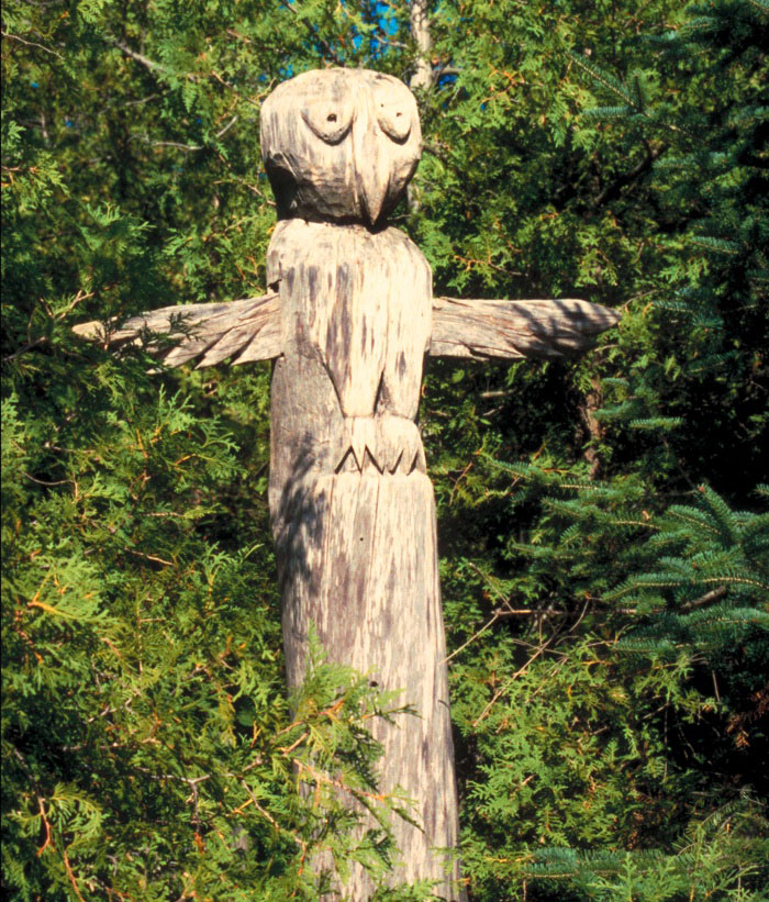
At Browning Cove, you might come across one of the historic items of the North Channel—this unusual totem. You'll have to go hunting for it, since it's not obvious. Photo by Venetia Moorhouse...
You will pass several nice harbors along the way, notably Aird Island (NC-44), and Moiles Harbour (NC-47). Continue west, using Chart 2259 to Turtle Rock. Here we have a choice of John Harbour (NC-49) on the south side, or Beardrop Harbour (NC-51) on the north. Sailboats seem to prefer the more open John Harbour, but we have planned on the more sheltered Beardrop.
Day's run, 20 miles.
Eleventh Day
Charts: CHS 2251, 2259, 2295
After leaving Beardrop Harbour, we will head across to Meldrum Bay for refueling before the long run home. (Blind River, NC-59, is an alternate fueling and supply stop—again, check for adequate depth.
Pilot Cove, on the northeast corner of Drummond Island, is a perfectly protected spot—but the entrance is shallow and a challenge! Photo by Fred May...
From Beardrop, leave Whitcher Island and Scott Island to starboard, by running the (reciprocal) Beacons-in-Line (056º T) steamer track. This reciprocal will of course be 56º plus 180º, which equals 236º T. Try to hold accurately on this range, reading the course "per ship's compass."
Two small islands called The Cousins will be almost dead ahead. When abeam of Scott Island, change course from 236º T to 240º T. This should lead north of The Cousins by at least their own diameter, and, if held accurately, will lead just west of Batture Island off Meldrum Bay.
Refuel here, and if the weather is still favorable go on to Pilot Cove (NC-7) for the night.
Pilot is a tight entrance, and you don't want very much of a sea running. Keep the bow up close to the point on your left, so that the props will be in the deep water as you make the turn.
Day's run, 45 nautical miles
Alternate: Tolsmaville, Cockburn Island (NC-9) or Kitchner Island (H-48?)
Twelfth Day
Charts: CHS 2295, US 14880
The proposed circuit is to leave the North Channel via False DeTour Passage and round the south side of Drummond Island to Whitney Bay (H-52). If you choose this route, be extremely cautious approaching Big Shoal on the south side of Drummond, as there is as much as 104 feet of water just west of the shoal, and even a fathometer will not warn you in time. You must locate red nun buoy "2" to be sure you will clear the rocks which are awash at LWD. See also US Charts 14882, 14880.
You may instead want to retrace your track from Pilot Cove northward around Drummond Island to Drummond Yacht Haven so that you may easily accomplish the duties of checking into customs and yet still overnight at Whitney Bay (H-52) by going south through DeTour Passage.
One major factor in this choice is to avoid Big Shoal as an unnecessary risk as it puts one almost a mile offshore in the presence of rocks awash, with no promise of gentle seas. See the photo of Big Shoal in Scammon Cove (H-49).
At any rate, do not forget to "check in" with US Customs and Immigration officials. Easiest "check in" is at Drummond (NC-1) or Whitney Bay (H- 52), although you can do it by radiotelephone if you have previously purchased the required decal.
Day's run, 26 nautical miles.
Alternate: DeTour Village (H-83)
Thirteenth Day
Out of deference to superstition, let's count this as that day we lost, holed up for wind or fog!
Fourteenth Day
Charts: US 14881, 14882
From Whitney Bay and DeTour Reef Light, head for Martin Reef Light, passing south of it. Here again a choice is possible. If the going is rough, you may wish to run through Les Chenaux Islands. Otherwise, continue on to Mackinac Island and the completion of the two-week tour.
Day's run, 35 miles.
Advice for the Navigator
For the cruiser who is planning the first trip into the northland, the Great Lakes Cruising Club offers certain suggestions and advice.
First of all, there are certain international complications involved when cruising into foreign water which must be observed. They are explained in another section of this book under the heading, "If You Are Going to Cruise in Canada."
The second suggestion is to know your compass error. In fact, we urge this as imperative. Canadian charts give true courses of many ranges using both lights and natural features such as mountains. When following or crossing these charted courses, check your compass. Note that in many of the close, rock-strewn passages of the North Channel, electronic positioning devices (GPS) will often be of minimal value, as piloting must be done by eyesight, compass, and range, and the margins of error may be less than a boat length.
Compass error is made up of two elements. The first of these is the magnetic variation of the earth. In the North Channel this variation is considerable, and it is not the same in all parts of the area. You will find the variation shown on the Canadian charts either in the different compass roses or in the caption area printed on each chart.
The second part of the error is in your own compass. (It is a very rare compass that has no such error--called deviation.) Deviation of a compass is usually different for the different directions your boat is headed. In most books on seamanship, you will find instructions for figuring out a deviation table for your compass and also instructions on how to take variation and deviation into account in your navigation. Going into the North Channel without a full knowledge of your compass and how to figure true and compass courses and bearings is foolhardy. To do the job right is easy, but learn how before you get there.
In the third place, you should know about general weather conditions. The weather here is as good as on other parts of the lakes, but each area has its own problems and forewarned should be forearmed. Summer squalls, fog, and smoke from forest fires are the greater unexpected hazards. Forest fires are less numerous than they used to be and fog will usually give you sufficient warning to enable you to select a protected anchorage.
Fogs in the early morning are usually of short duration and seldom occur during the day in the summer months.
To be sure of making good daily progress, get up early and do your passagemaking during the forenoon. The North Channel lies in the principal track of the storms crossing the continent traveling from the western mountains to the east coast. A majority of the winds through these waters are easterly or westerly, mostly westerly, sometimes with no force and again with considerable.
Very often your winds will change with seeming regularity, with one wind prevailing in the morning and the opposite in the afternoon. Then again, you may run into a stiff, three-day blow from one direction that will make you decide to stay put, with your hook and the protecting lands for company. A majority of the heavy winds come from the sector between southwest through west to north and follow a wind and rain from another direction, and are in force and duration in proportion to the fall of the barometer.
After August 15, there are likely to be strong westerlies. Boats from the west (Lake Michigan) usually try to be homeward bound by this date.
Don't plan your cruise in long hitches. If the weather and conditions are favorable, go as far as you choose, but have a close destination always in mind that you can run for if things don't look right. Be constantly alert! A sudden rain with a change of wind, though of short duration, may take you 200 yards off your course very quickly and that may be too much in narrow waters.
Always Plan to Make Your Harbors Well Before Dark. When traveling through ticklish rocky waters, plan your trip so that the sun will be behind you. Rocks will then be visible that would otherwise not be. Keep a lookout well forward and another one as high as possible. Polarizing type sunglasses are a very great help in seeing shoals, and should be used whenever there are underwater obstructions nearby. When possible, time your departure so that your passages through, or arrivals in, strange channels or new harbors will occur between 11 am and 3 pm when the sun is high.
In the fourth place, always know where you are and where you are going! Have your proper charts and the Canadian Coast Pilot (Sailing Directions) and use them constantly. If you follow the sailing directions in the Coast Pilot, use the charts properly, and pay due attention to warnings in the reports of the GLCC Port Pilot and Log Book, you should have few troubles.
One of the big problems in North Channel cruising is in identifying an island or headland to be used in navigation. It is all very well to say steer for Jones Island but which is Jones Island? Know ahead of time what you are hunting for. Some navigators make rough notes listing their program from information from the chart, Coast Pilot, and this Log Book.
In this matter learn to use the Coast Pilot. At first it can be very confusing as the descriptions follow shores, and in narrow waters the description of one side of a channel may well be several pages from the description of the other side. Knowing where you want to go, note the names of land objects on both sides of the course from the chart and then look in the Coast Pilot index for these. Keep at least a rough pencil course line going on your chart. While it may be best to constantly get bearings and plot the course exactly, most navigators don't have the time for this, especially in confined waters—they plot fixes from time to time and keep a rough pencil course line.
The navigator should have the chart in view and should be constantly identifying landmarks even though you may not immediately need to use them. Many navigators sight across their charts to help in identification.
Another problem in North Channel cruising has to do with the water depths. Soundings are not of much help in many areas, for depths will go from 30 feet to 3 feet in a distance of much less than a boat's length. Pinnacles abound. Where we say "proceed with caution" or "keep a sharp lookout," it is against such we are warning. Under such conditions, going slowly with a lookout as high up as possible is good sense. (Lookouts will see more ahead if the sun is at their backs. If the sun is ahead, polaroid glasses may cut down the glare and show up bad spots.) The levels of our lakes vary from one month to another. Also each year there is a water-level variation working on some sort of cycle not clearly understood. For chartmaking, the governments involved have had to use some base altitude referring to sea level. They have what is called a "Low Water Datum" (LWD) for each lake. For Lake Huron the presently adopted level is 576.8 feet above mean sea level. This gives the chart maker a base for the soundings. What does this have to do with you?All US Charts show soundings as if the water level was down to Low Water Datum (LWD). If the water is actually higher than LWD, there is more water than shows on US Charts. How much more? You may get this information from your nearest US Coast Guard Station. It is also available at Little Current, where a gauge is maintained on the west end of the Government wharf.
Many older Canadian charts were made using a datum or base higher than the present water level. This means that on these charts there is less water than shows on their charts. Read each Canadian chart caption to see how much must be subtracted from soundings shown to reduce their soundings to the presently adopted LWD.
(Their charts use various datums so check each chart as you use it.)
You can get on the mailing list for the Free Weekly Notice to Mariners by writing to Commander, 9th Coast Guard District, Main Post Office Bldg., Cleveland, Ohio 44113.
In our Log Book Harbor Reports we have tried to reduce all soundings to LWD or to call attention to deductions if any are necessary, as for example when we reproduce the older Canadian charts.
While there are plenty of stories of mishaps in the North Channel, most of the grief experienced has been limited to a bent propeller or shaft, with the resultant loss of time and money.
In almost every case we have encountered, yachts hit charted obstructions. The prime causes are: 1) Failure to keep up the navigation and know where you are at all times. 2) Turning too soon (or too late) at the junction of two courses. 3) Following someone else, trusting the other person to do the navigating.
Illustration by GLCC Commodore Vaughn Shoemaker, 1949...
A classic story is in order here, which should make the point: Four power yachts (up to 40 feet) were seen to be standing into danger north of the James Foote Patch, 7 miles west of Little Current. Fortunately they were stopped by an urgent radio call, just short of shallow water. Later conversation revealed that they had only one chart for the four boats, so took turns, with a different leader each day! The one chart? Oh yes, it was US Chart 14860, Lake Huron as a whole.
In the fifth place, remember that one of your reasons for going to this area is for its beauty and seclusion. This means you will not find frequent places for ice, fresh milk and meat, groceries, gas and oil, doctors, etc. This book gives information on such places. Be sure to plan your supplies. In general it is well to stock up to capacity every chance you get.
The shore to the south separating the Channel from lake Huron is mostly limestone with a much heavier growth of timber than on the north shore. A considerable amount of the land on the south has been cleared for farming and there are towns and improved harbors.
Today there are only several towns left on the north shore, though there are the remains of many that were flourishing as recently as 25 years ago. The old chimneys of the mills and the homes as well as the remains of miles of docks tell the story of the great conflagrations that have taken place and that have laid waste much of the timberland of this country.
In the sixth place, if you build a fire on shore for any reason, be sure it is completely out before you leave or you may have a very unpleasant experience with the Canadian authorities (and rightfully so).
While you cruise in Canadian waters, you are a guest of Canada. Don't make yourself unwelcome. When entering a foreign port or cruising in their waters, the national ensign of the country should be flown from the foremast head of a schooner, from the starboard spreader of other types of sail boats, and from the bow staff on powerboats. This is a courtesy to Canada we should observe.
Bon Voyage!
Report by Howard C. Blossom and Ron Dwelle
10/20/2008 rd
The 2004 Log-Book committee
Proudly dedicates this harbor report
As well as the entire North-Channel section
Of the GLCC Port Pilot and Log Book
To the memory of
Howard C. Blossom
Inveterate North-Channel explorer and
GLCC Fleet Captain, 1954-1994